Beulah
The township of Beulah is a prosperous agricultural community between Hopetoun and Brim. Beulah owes its origins to the arrival of the early pastoralists in the mid 1800’s who were following the course of the Yarriambiack Creek as it flowed north to Lake Corrong near Hopetoun. Beulah claims that it's the closest town to the netting fence they built in the forlorn hope of containing the hordes of dogs. The erection of the fence commenced in 1885, and was constructed by the Victorian Government, as a measure to control wild dogs (dingoes) and foxes from the north and rabbits from the south.
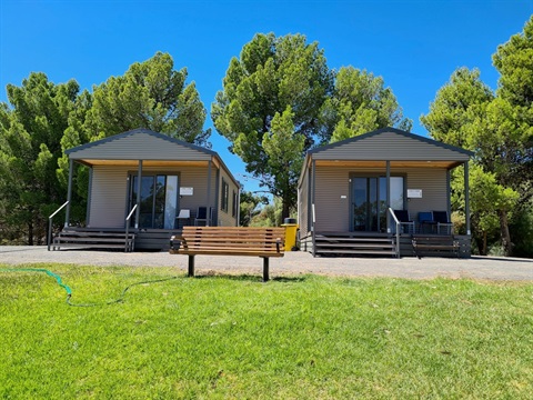
The picturesque Yarriambiack Creek that runs through Beulah is a true oasis, with walking tracks and picnic and camping areas stretching along its serene banks. A caravan park including new Creekside cabins with public amenities is located beside the creek.
The scenic Yarriambiack Creek that flows through Beulah is a relaxing retreat and has walking tracks and picnic and camping areas stretching along its serene banks. Powered and non powered boating is permitted. The Beulah Opportunity Shop is a haven for vintage hunters.
Murals depicting Beulah’s heritage scatter the township and a tour booklet can be purchased from the Beulah Business and Information Centre located in Phillip’s Street. The Centre also provides tourist information, internet access, cafe, meeting room hire, administrative and banking assistance, Australia Post and historical research.