Our Region
Yarriambiack Shire Council was formed on 19 January 1995 by the amalgamation of the former Shires of Karkarooc and Warracknabeal, most of the Shire of Dunmunkle and part of the Shire of Wimmera. It has an area of 7158 square kilometres and has a projected population of 7,315 for 2013. The Shire stretches from the Wimmera River just north of the Grampians in the south, to the centre of the Mallee in the north. The Yarriambiack Creek is the main natural feature traversing the Shire. The area is also linked by road and rail systems that run in a north-south direction. The area has an almost ideal climate with a short winter and delightful autumn and spring. Summer temperatures can be hot, particularly in the north.
Warracknabeal is the main service centre of the area, with a catchment pattern that extends from the northern Wimmera to the Southern Mallee. It is complemented by Hopetoun in the north and Minyip, Murtoa and Rupanyup in the south, with another eleven small towns spread throughout the municipality.
Of the population, almost half the workforce is employed in agriculture. Many other residents depend indirectly on farming, as they are employed in services used by the farming population. The population trends are remarkably similar to other areas across most of the Wimmera/ Mallee. The rural areas and small towns have tended to lose population, while the population bases of the larger towns have shown more stability.
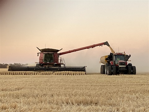
The Shire is the heartland of grain production and handling in the Wimmera/Mallee. The dry-land farming area produces one quarter of Victoria’s total production of wheat and barley and is noted for the production of lambs and wool. Legume and oilseed crops are very important and alternative livestock enterprises are also well established.
The number of farms in the municipality has steadily declined with the average farm increasing in size. Changes in farm size and numbers reflect increased efficiency – less people producing more in order for the grain industry to remain profitable in the face of deregulated markets and declining returns. The Wimmera/Mallee constitutes one of the most efficient grain growing areas in the world.
The Shire is well situated to serve the needs of local economies and communities and promote and facilitate increased public and private investment in developing its grain and related industries. Warracknabeal is the sub-regional centre for the northern Wimmera and southern Mallee, with excellent facilities for shopping, aged care, health, recreation and other commercial activities. The saleyards are an important selling feature. There is an industrial estate with sites available for development.
The Shire is situated between the Grampians and Murray Tourist Regions and provides a link between Horsham in the south and Mildura in the northern end of that region. It is located immediately to the east of some of Victoria’s main eco-tourist attractions, including the Big Desert, Wyperfeld National Park, Lake Hindmarsh, Lake Albacutya and the Little Desert.
As well, there are a number of significant other attractions, including the Murtoa Stick Shed, Woods Museum, Minyip Heritage Town, Yarriambiack Creek, Warracknabeal Machinery Museum and Historical Centre and the Heritage Homesteads at Hopetoun. The potential for Shire wide and Region wide tourism developing in such a diverse region provides an exciting opportunity for the municipality.